The release of DJI Terra V5.0 marks a major step forward in 3D reconstruction for professionals in surveying, mapping, infrastructure, and agriculture. This latest version introduces powerful new capabilities, including Gaussian Splatting, enhanced LiDAR and photogrammetry performance, and an overall improvement in workflow efficiency for demanding, large-scale projects.

One of the standout upgrades in Terra V5.0 is the introduction of Gaussian Splatting, a next-generation rendering technique that produces highly realistic 3D models from RGB imagery. This method significantly improves how reflective surfaces, glass structures, dense vegetation, and architectural details are rendered, offering a more complete and natural visual output compared to traditional mesh modeling.
Gaussian Splatting also delivers performance gains. For projects involving over 10,000 images, Terra can now reconstruct 3D models in nearly half the time of previous mesh-based workflows. The platform supports up to 30,000 images in a single task on high-end systems, making it well-suited for city-scale modeling. What makes this even more accessible is that Terra V5.0 runs smoothly on machines with just 32 GB of RAM and 4 GB of GPU memory, removing the barrier of needing high-end hardware. Results can be exported in widely used formats such as PLY and B3DM, ensuring compatibility across industries including surveying, visual effects, and game development.
In terms of photogrammetry, Terra continues to offer highly accurate mapping without requiring ground control points. By integrating tightly with DJI drones equipped with RTK modules, the software consistently meets 1:500 mapping standards, delivering centimeter-level accuracy for engineering, construction, and topographic surveys. Terra supports 2D and 3D outputs, including orthophotos, DSMs, point clouds, and mesh models, that can be easily exported for use in downstream applications.

Performance is a critical part of Terra’s value. For smaller mapping missions, results can be generated in real time or on-site, which is ideal for time-sensitive operations. For large-scale projects, Terra can process 30,000 images in less than a day using cluster reconstruction, which distributes processing across multiple machines to reduce turnaround time and improve scalability.
For environments where photogrammetry alone is not sufficient, such as complex structures, infrastructure inspections, or heavily obstructed areas, LiDAR reconstruction adds another layer of capability. Terra enables seamless integration of LiDAR point clouds with RGB imagery, creating dense, accurate 3D models. Using RTK and PPK technology, Terra delivers centimeter-level precision without requiring manual ground control points, even in challenging or GPS-denied environments.
Terra can process up to 120 GB of point cloud data on a 32 GB RAM system, covering areas as large as 10 square kilometers (1000 ha). It also supports high-performance setups for even larger projects, ensuring users can scale operations with confidence.
In agriculture, Terra V5.0 offers expanded support for multispectral data collected from drones like the DJI Mavic 3 Multispectral and Phantom 4 Multispectral. Users can generate vegetation index maps such as NDVI and NDRE, along with reflectance maps and radiometric corrections. These insights support crop monitoring and agricultural research. Terra also enables users to produce prescription maps tailored to different crop types, which can be directly used with DJI Agras drones to optimize spraying and increase yields.
The cluster reconstruction capability introduced in Terra V5.0 significantly enhances processing speed for enterprise-level projects. For example, a five-node setup can process 30,000 high-resolution images in about 21 hours, a dramatic reduction in time for city-wide 3D modeling. As project needs evolve, users can scale the number of worker nodes to handle growing datasets without slowing down production timelines.
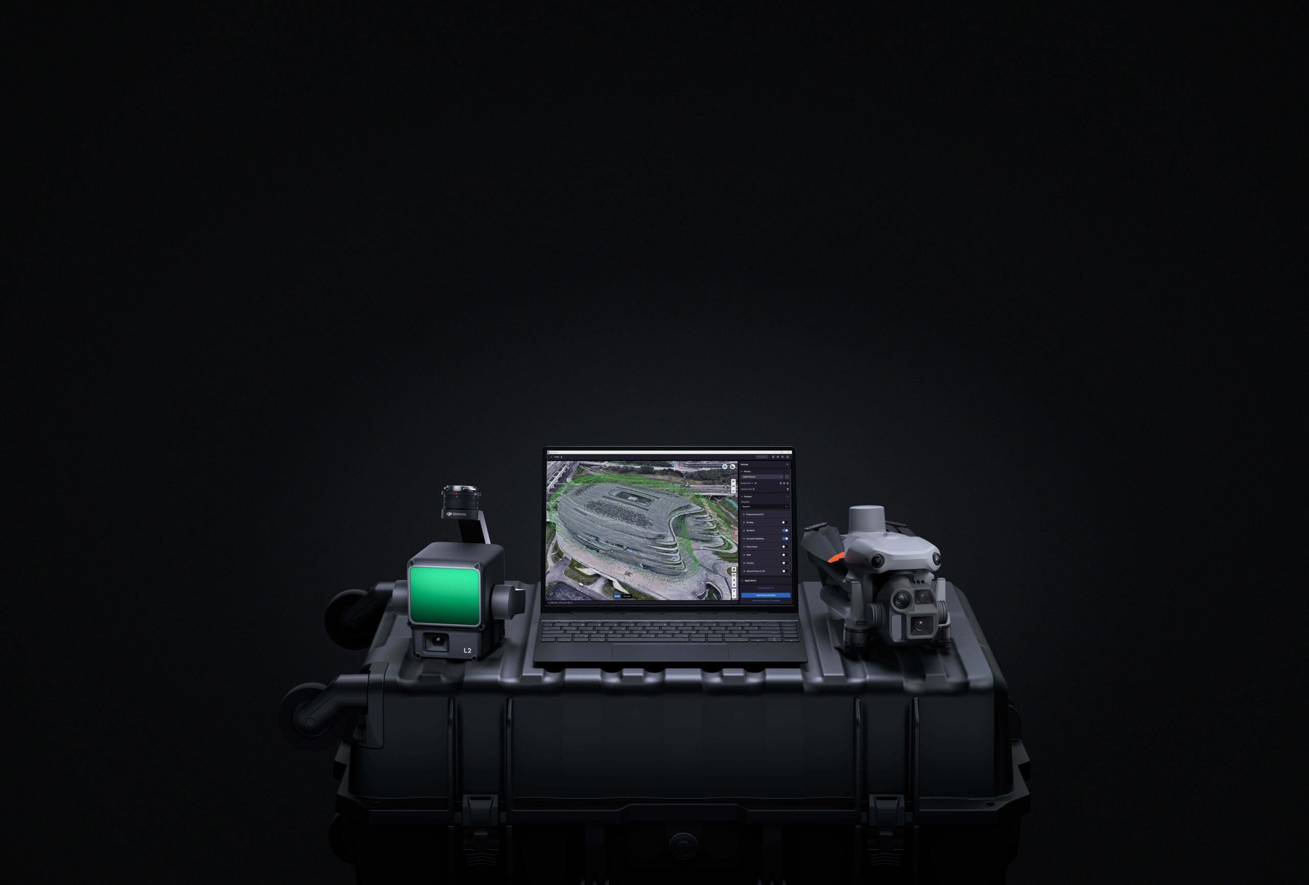
Terra’s integration with DJI enterprise drones and payloads, including the Matrice 4E, Matrice 400, Zenmuse P1, Zenmuse L2, and D-RTK 3, ensures seamless data acquisition and processing.

Additionally, users who need to refine models with point cloud smoothing, noise reduction, and classification can leverage DJI Modify, the companion post-processing tool. These models can then be exported into standard GIS or CAD platforms, supporting workflows in civil engineering, urban planning, and emergency response.
Other features include built-in PPK processing, allowing high-accuracy mapping even in areas without real-time correction. Terra also supports over 8,500 coordinate systems, PRJ file imports, and seven-parameter transformations for global compatibility. Users can mark control and check points with sub-pixel accuracy using semi-automated tools, and conduct detailed annotations and measurements within the model.
DJI Terra V5.0 is more than just an upgrade, it’s a comprehensive, end-to-end platform for transforming aerial imagery into high-accuracy, photorealistic 3D data. With faster processing, expanded hardware compatibility, and deep integration across DJI’s ecosystem, it empowers professionals to digitize the physical world at unprecedented speed and scale.
To learn more about DJI Terra V5.0, connect with our team of enterprise specialists.


