Capture images with the Pix4D app, process on desktop or cloud, and create maps and 3D models.
Pix4D
A UNIQUE SUITE OF PHOTOGRAMMETRY SOFTWARE FOR DRONE MAPPING

DELIVERING
Powerful Photogrammetry Software Technology
Pix4D makes software solutions for professional drone-based mapping, purely from images. Its vision of modern photogrammetry is transforming workflows and the use of drone data and aerial imagery across various industries.
Pix4D SERVES MULTIPLE ENTERPRISES:
Pix4D SERVES MULTIPLE ENTERPRISES:
Real Estate
Ideal for real estate developers seeking accurate mapping and 3D presentations for investors, and brokers needing precise measurements and eye-catching visuals for listings.
Inspection
Home inspectors who need to examine roofs and chimneys without using ladders.

Public Safety
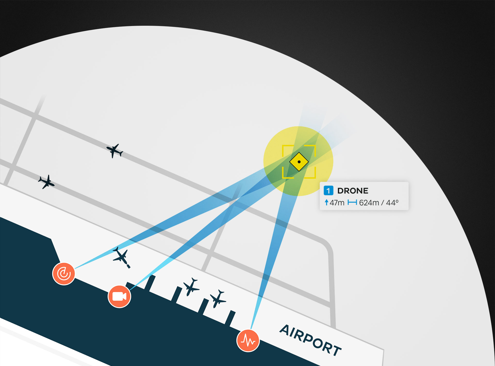
First responders who need highly accurate maps to respond accurately to emergencies, and who need to map crime or fire scenes.
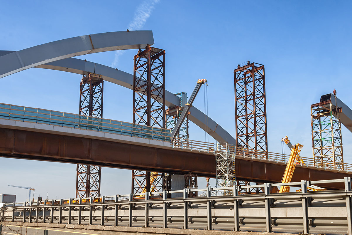
Construction
Engineers who need to measure distances and calculate areas quickly. Construction contractors who need to monitor and illustrate progress on jobs, act on the data collected, and coordinate team activities.
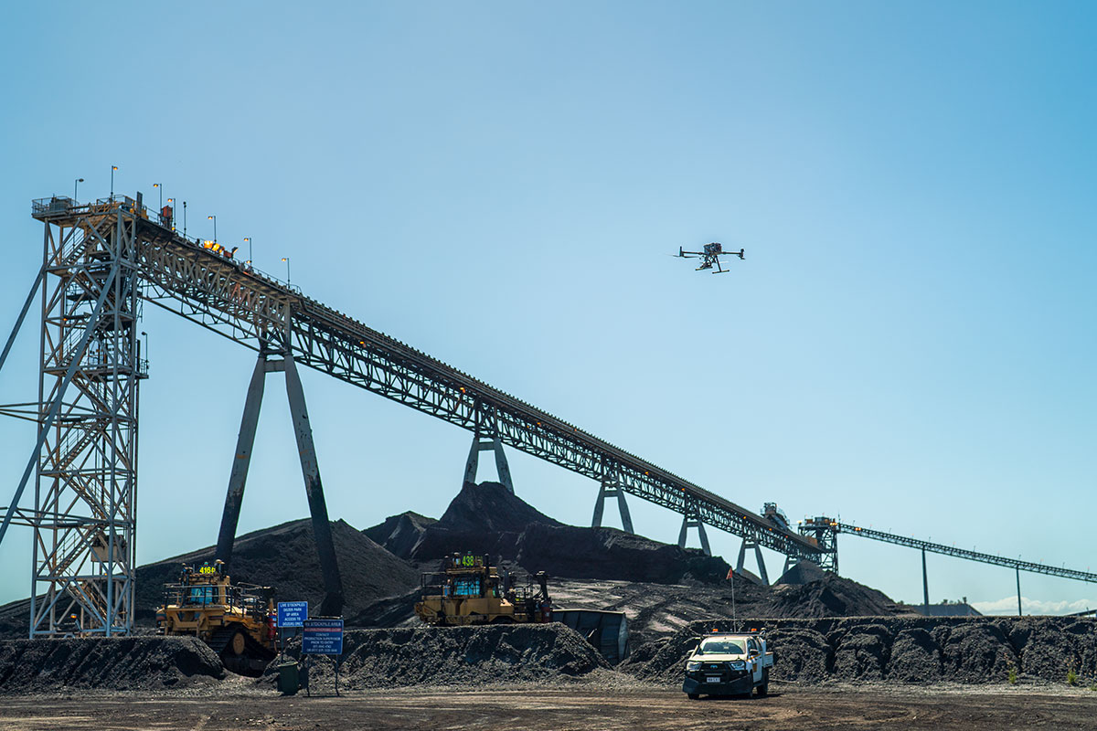
Mining
Mining professionals who need to measure distances, calculate volumes, and make geotechnical assessments.
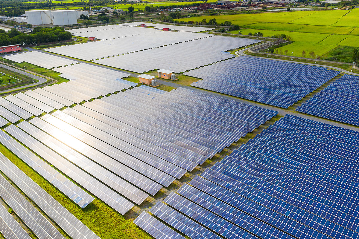
Energy
Industrial inspectors who need to safely evaluate tall, remote or sprawling assets, such as cell towers, high-power lines and towers, wind turbines and solar arrays.
PIX4D ADVANTEGES
DJI Compatible
Pix4D is compatible with any DJI drone, enabling it to function as a data collection tool for aerial mapping and 3D modeling.
Ortho-Corrected Images
Pix4D corrects 2D images for scale, topographical relief, lens distortion and camera angle, assembling a dimensionally accurate 3D mosaic.
Heightened Efficiency
Drones enabled by Pix4D gather data and images for aerial mapping and modeling in a fraction of the time needed by ground-based teams.
Exportable Data
Data processed by Pix4D can be exported to a range of other programs, including CAD and GIS, for deeper analysis, and shared by multiple users.
THE ONLY DRONE MAPPING & PHOTOGRAMMETRY SOFTWARE TOOLS WITH A FLIGHT APP, DESKTOP, AND CLOUD PLATFORMS
Pix4Dmatic
Next-generation photogrammetry software for professional terrestrial and drone surveying.

PIX4Dmatic Advances to a Unified Geospatial Platform
PIX4Dmatic and PIX4Dsurvey are now integrated into a single PIX4Dmatic license. Combined with major tools and ongoing performance improvements, the platform now provides a more powerful and efficient environment for producing modeling and survey deliverables.
Easy to Learn
PIX4Dmatic is easy to learn and quick to start using in production. A powerful professional software that combines simplicity with advanced capabilities.
Terrestrial Workflow
Choose between depth or dense point clouds, or combine both. Create an accurate 3D model with LiDAR and photogrammetry using the PIX4Dcatch mobile app and an RTK-enabled device.
Powerful Tools
Turn images into insights with crop health maps, field reports, spot spraying, and prescription maps for your agricultural machinery.
Pix4Dcloud
Professional photogrammetry on the cloud.
Accurate Results
Rely on Pix4D’s processing algorithms to get survey-grade results from images. Choose the AutoGCPs feature for even greater accuracy.
Analysis Made Easy
Get an instant view of any jobsite from anywhere, on your browser, in 2D and 3D, with results you can measure, explore, compare, share, and collaborate on.
Up-to-Date Documentation
Keep a permanent visual archive of your jobsite. Resolve disputes with stakeholders and clients more efficiently.
Pix4Dcatch
Turn your mobile phone into a 3D scanner and capture the world.

Augmented Reality: Visualize with Precision
Overlay point clouds, CAD models, or GCPs in AR to compare and analyze on-site for quick decisions.
Quick Volume Calculation
Measure stockpiles or flats in seconds and share results instantly for faster decision-making.
GCP Workflow: Simplified Accuracy
Boost precision effortlessly with our easy-to-use Autotags.
RTK-Ready Survey Tool
Combine Catch with GNSS for precise point measurements, usable as GCPs or in AR.
Trinity Workflow Integration
Seamless data transfer between PIX4Dmatic, PIX4Dcloud, and PIX4Dcatch for maximum efficiency.
Pix4Dmapper
Photogrammetry software for professional drone mapping.

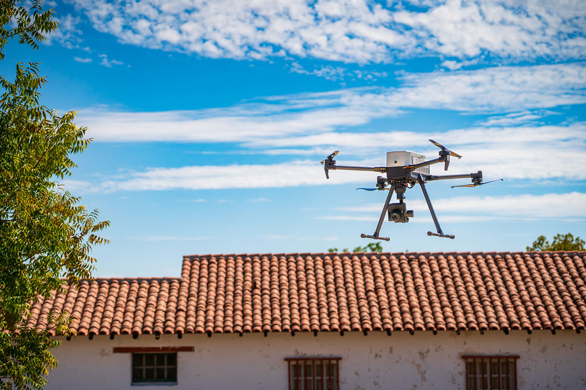
Capture
Capture RGB, thermal, or multispectral images with any camera. Automate flights and image data transfer using a drone and the free PIX4Dcapture app.
Digitize
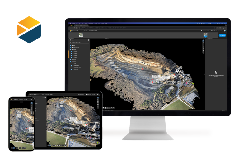
PIX4Dmapper’s photogrammetry algorithms convert your images into digital maps and 3D models. Process projects easily on your desktop or bundle with PIX4Dcloud for online processing.
Control & Measure
Evaluate and enhance project quality with a detailed report and the rayCloud™ environment, while efficiently measuring distances, areas, and volumes.
Collaborate and Share
Share project data and insights securely and selectively with your team, clients, and suppliers.
Pix4Dreact
The fast mapping software for emergency response.
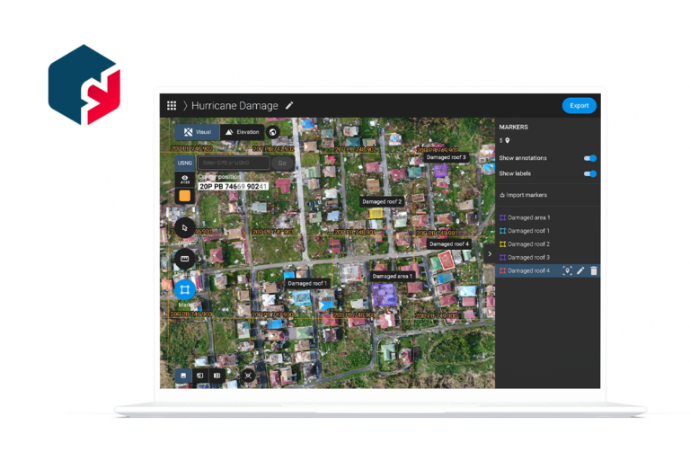
Fast
PIX4Dreact quickly creates 2D maps from aerial imagery, delivering up-to-date and reliable information when every second counts for teams on the ground.
Easy to Use
PIX4Dreact is simple and intuitive to use, even in complex, high-pressure situations. Developed alongside public safety and humanitarian aid professionals, it is designed to meet their unique challenges.
Lightweight & Robust
PIX4Dreact is lightweight enough to run on a mid-range laptop in the field, without needing an internet connection or cloud processing.
Easy Sharing
Share your data as a PDF report, or in industry-standard formats.
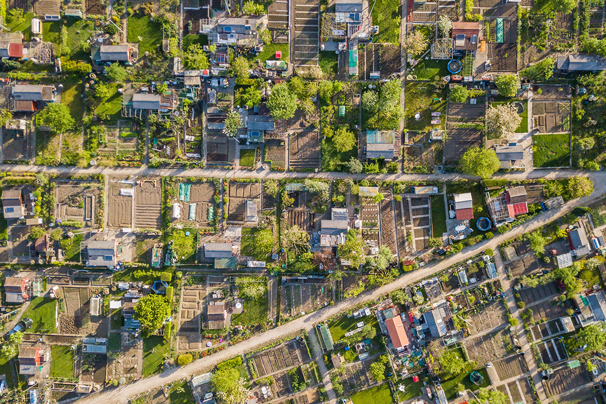
Pix4Dfields
Field mapping and aerial crop analysis for digital farming.
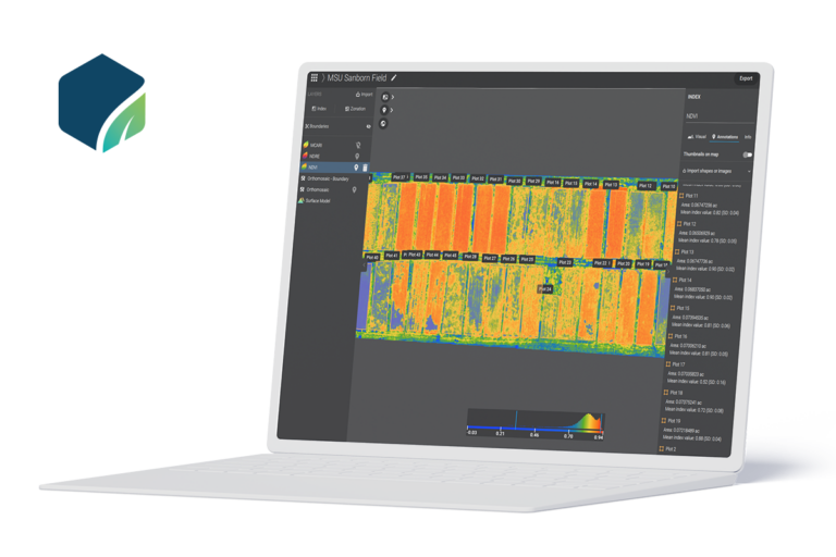
In-field Results
Quickly create maps offline for fast decision-making and action, right from the field.
Accurate Maps
Generate maps of your fields and crops at any stage using satellite or drone imagery.
Powerful Tools
Turn images into insights with crop health maps, field reports, spot spraying, and prescription maps for your agricultural machinery.
Easy Sharing
Share your data as a PDF report, or in industry-standard formats.
USING PiX4D
Safety and precision increase with Pix4D. Workers stay on the ground while the drone accesses conditions in otherwise hazardous places — towers, high-rises, bridges, busy highways, rooftops and emergency environments.
GPS and geo-tagging allow drones to return to precise points to gather updated data on construction, for example, or on evolving crop and field health.
Using Pix4D in mining operations allows equipment to continue to operate while data is collected for inspecting infrastructure, measuring stock, assessing geotechnical conditions and planning blasts. Errors decrease with the elimination of fatigue from ground-based data collectors.