Agriculture teams need field data they can act on. Drone and satellite imagery can capture valuable crop information, but imagery alone does not always tell growers, agronomists, or agricultural enterprises what to do next.
Agremo helps agricultural teams connect aerial imagery to crop monitoring, agronomic insights, reporting, and spray-execution workflows.
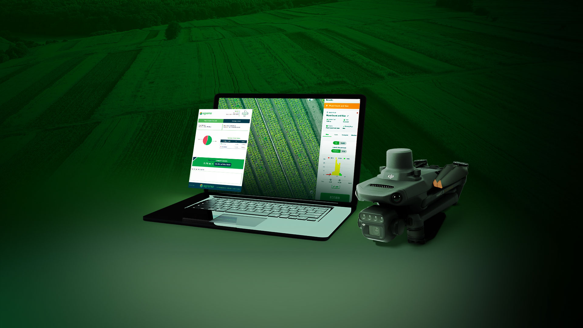
Agremo is a precision agriculture platform that transforms drone and satellite imagery into actionable insights for farmers, agronomists, and agricultural enterprises worldwide. Its workflow moves from drone flight and image stitching to AI analysis, prescription maps, and field action.
The Benefits of Agremo for Agriculture Teams
The platform is built around two core workflows: agronomy insights and spray execution. The agronomy workflow includes stitching and indices for RGB and multispectral imagery, AI insights such as stand count, weed detection, and vigor or health analysis, and grower-ready reports that can be compared over time. The spray execution workflow includes ready-to-fly boundaries and zones, flat, spot, and variable rate application prescriptions, and shareable maps and reports.
This workflow connects imagery with AI analysis, prescription maps, and field action.
How Agremo Turns Drone Imagery Into Action
Agremo’s process is designed to move field teams from data capture to decision-making in a single workflow. Here’s how it works:
- Fly a drone
- Stitch images
- Run AI analysis
- Create prescription maps
- Take action
This structure helps teams avoid treating imagery as a standalone deliverable. Instead, the goal is to convert imagery into field-ready outputs that support operational decisions.
The Supported Crop Monitoring Analyses
Agremo’s crop monitoring capabilities include on-demand AI analyses, real-time plant health analysis, and satellite-based field monitoring.
On-demand AI analyses can deliver detailed insights within up to 24 hours. Real-time plant health analysis is available instantly after map upload and is based on vegetation indices. Agremo also supports continuous field monitoring through satellite imagery, with insights available immediately after field creation.
Agremo’s crop monitoring analyses include:
| Plant Vigor | Supports crop health and vigor assessment |
| Weed Detection | Helps identify weed pressure for targeted management |
| Canopy Cover | Provides visibility into crop coverage |
| Plant Count and Size | Helps quantify plant development |
| Waterlogging | Supports identification of water-related field stress |
| Lodging | Helps assess crop displacement or damage |
| Green Snap | Supports detection after wind-related damage |
Crop Monitoring and Spray Execution
Agremo includes tools for data processing, agriculture analysis, spray prescriptions, reporting, and compatibility.
The data processing and platform include RGB and multispectral stitching, GeoTIFF upload and export, elevation maps, and exports in JPG, PDF, SHP, and KML formats.
For spray execution, Agremo includes operational planning for boundaries, obstacles, and no-spray zones, as well as fertilizer and spraying tools and map customization. Its agriculture tools include ARY – Digital Agronomist, zone management, a biomass calculator, a corn yield calculator, weather data, measurement and annotation tools, early crop alerts, a compare tool, co-branding, and farmer view-only access.
Optimize Agriculture Operations with Agremo
Agremo’s listed use cases include:
- Replanting decisions in corn using AI stand count analysis
- Invasive species detection in pasture using AI weed detection
- Variable rate fertilization in corn using AI plant vigor
- Weed spot spraying in soybeans using AI weed detection
- Green snap detection in corn after a windstorm
- Rice yield estimation using AI stand count and the biomass calculator
These examples show how Agremo-powered analytics can support different agriculture workflows, from identifying weak zones to preparing spray or fertilization strategies.
How does Drone Nerds support agriculture teams using Agremo?
Drone Nerds offers access to Agremo-powered agriculture analytics and can help agriculture teams evaluate the drone hardware, payloads, software workflows, training, and support needed to use aerial data effectively.
How Drone Nerds Can Help
For agriculture teams, Agremo-powered analytics may need to work alongside drone hardware, payloads, training, and support. Teams also need the right drone platform, payload, imagery workflow, training, and support model.
Drone Nerds helps organizations adopt, deploy, and scale drone programs through hardware, software, services, training, support, repairs, and lifecycle assistance. For agriculture teams using Agremo-powered analytics, Drone Nerds can help evaluate how drone hardware, imagery workflows, payload requirements, and software tools fit the operation.
Before implementing an AI crop analytics workflow, teams should consider:
- What crops and field conditions need to be monitored
- Whether they need agronomy insights, spray execution, or both
- How reports will be shared with growers or internal teams
- Whether the drone platform, payload, and software workflow fit the operation
Drone Nerds’ role is to help teams choose and implement the right drone solution so they can operate efficiently and make practical use of their field data. Speak to an expert to learn more.
FAQ
What is Agremo?
Agremo is a precision agriculture platform that transforms drone and satellite imagery into actionable insights for farmers, agronomists, and agricultural enterprises worldwide.
What types of analyses does Agremo support?
Agremo supports analyses such as stand count, plant vigor, weed detection, canopy cover, plant count and size, waterlogging, lodging, and green snap.
Does Agremo support spray prescriptions?
Yes. Agremo supports spray prescription workflows, including flat, spot, and variable-rate application prescriptions, along with operational planning for boundaries, obstacles, and no-spray zones.
Can Agremo use drone and satellite imagery?
Yes. The Agremo is a platform that transforms both drone and satellite imagery into actionable agriculture insights. It also notes continuous field monitoring powered by satellite imagery.


