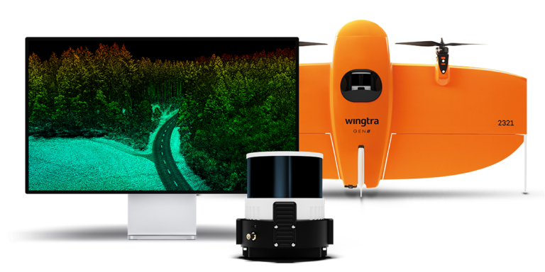
WingtraOne GEN II
A MAPPING DRONE FOR FAST AND ACCURATE SURVEYING DATA EVERY TIME
The WingtraOne GEN II is engineered to maximize efficiency and precision in aerial mapping operations. With its unique VTOL capabilities and industry-leading camera integrations, this drone minimizes flight time while delivering high-accuracy data. The WingtraOne GEN II can take-off and land almost anywhere—even in confined spaces or on rough terrain. This enables you to collect data where other drones cannot.

Photogrammetry
- Flight Time Up To 59 min
- Full-frame Camera 61 MP
- Lowest GSD 0.28 in/px
LiDAR
- Coverage in a Single Flight890 ac
- Vertical Accuracy Down to 1.2 in
- Up To 27 pts/ft²LiDAR
A DRONE YOU CAN RELY ON
A SENSOR FOR EVERY MISSION
WingtraOne GEN II delivers uncompromising aerial data quality, ensuring precision for orthophotos, 3D models, multispectral mapping, and LiDAR data. Designed for enterprise applications, it supports best-in-class sensors to meet the highest industry standards.

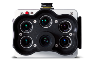
MicaSense RedEdge-P
MicaSense drone sensors help growers, land managers, and researchers use drone-based imagery to make informed decisions. They adapt easily to many drones for efficient crop scouting, agricultural mapping, field moisture evaluation and other ag-related measurements.
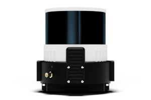
Wingtra LiDAR Sensor
The WingtraOne, equipped with a LiDAR sensor, delivers efficient, reliable, and user-friendly mapping, generating high-precision digital terrain models that penetrate dense vegetation for deeper terrain insights.

SCALE YOUR MAPPING OPERATIONS WITH EASE
Combine the coverage, precision, and ease of WingtraOne with the advanced capabilities of WingtraCLOUD to simplify your mapping workflow on a single, intuitive platform.