TRINITY PRO

Optimize Your Mapping Missions with the Trinity Pro

Trinity Pro is a future-proof mapping drone designed to adapt to changing requirements and accelerate decision-making through advanced aerial data.

The Mapping Drone for Professionals

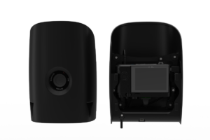
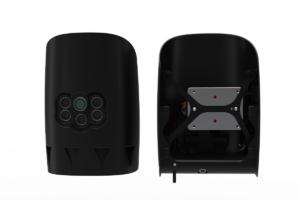
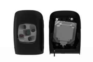
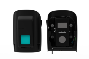
Trinity Pro features an extended flight time of 90 minutes and easy to use mission planning software QBase 3D. The choice of integrated cameras is unrivaled – RGB, Oblique, Multispectral and even LiDAR – making it the right tool for any mapping application.

Quantum Systems Trinity Pro mapping software
Drone Icon

Max. Flight Time: 90 min

Weather Resistant Icon

Wind Tolerance: 18 m/s

Coverage Area Icon

Max. Area Coverage: 700 ha

Drone landing icon

Max. Take-Off Weight: 5.75 kg (12.68 lb.)

Take-Off Altitude Icon

Take-Off Altitude: 4800 m

propellers icon

Optimal Cruise Speed: 17 m/s (33 kn)

Quantum Systems Trinity Pro flying over mining site
Quantum Systems Pilot carrying Trinity Pro drone
Quantum Systems Trinity Pro drone on a filed with pilots
Quantum Systems Trinity Pro drone close-up sensor

Accomplish Your Missions with Ease

Trinity Pro is designed to adapt to changing requirements, evolve in capabilities, and accelerate decision making through aerial data. Future integrations like AI capabilities give new insights and help professionals in various industries to make more informed decisions and drive their business forward.

The Trinity Pro incorporates the latest technology with the Quantum-Skynode autopilot and the Linux mission computer. This technology delivers increased computing power and internal storage, as well as enhanced connectivity onboard the aircraft.

SPEAK WITH AN EXPERT

Trinity Pro Cameras

Trinity Pro currently comes with six different fully integrated cameras, including RGB, oblique, multispectral and LiDAR. They are easy to swap using the quick-lock mechanism of the payload compartment. The entire system architecture allows easy downstream integration of next generation cameras and simpler workflows.

Quantum Systems Trinity Pro Sensors
Quantum Systems Trinity Pro Sony RX1 Sensor

Sony RX1 RII

Full-frame 42 MP Camera

    • Orthophoto & DEM
    • Point clouds & 3D models
    • 1.29cm/px @ 100m altitude
    • Sensor resolution: 42.4 MP (7952 × 5304 px)
    • Trigger interval: 1.4 seconds
    • Sensor type: CMOS
    • Sensor format: full frame
Quantum Systems Trinity Pro Sony UMC Sensor

Sony UMC

APS-C​ 20.1 MP Camera

  • Orthophoto & DEM
  • Point Clouds & 3D models
  • 2.66cm/px @ 100m altitude
  • Sensor resolution: 20.1 MP (5456 x 3632 px)
  • Trigger interval: 1.1 seconds
  • Sensor type: CMOS
  • Sensor format: APS-C
Quantum Systems Trinity Pro MicaSense RedEdge-P Sensor

MicaSense RedEdge-P

5 Spectral Band Sensor

  • RGB data with 6.94cm/px @100m altitude
  • Multispectral data for vegetation analysis
  • 1 flight => Orthophoto (5bands) & DEM & Point Cloud
  • Various indices for plant stress and health analysis
Quantum Systems Trinity Pro AltumPT Sensor

MicaSense Altum PT

5 Spectral Bands & Thermal Infrared Sensor

  • RGB data with 4.31cm/px @100m altitude
  • Multispectral data + thermal layer for enhanced analysis
  • 1 flight => Orthophoto (6bands) & DEM & Point Cloud
  • Various indices for plant stress and health analysis
Quantum Systems Trinity Pro ObliqueD2M Sensor

Oblique D2M

5 Spectral Bands & Thermal Infrared Sensor

  • RGB data with 4.31cm/px @100m altitude
  • Multispectral data + thermal layer for enhanced analysis
  • 1 flight => Orthophoto (6bands) & DEM & Point Cloud
  • Various indices for plant stress and health analysis
Quantum Systems Trinity Pro Qube240 Sensor

Qube 240

Geomatics grade LiDAR

  • 240,000 distance measurements per second
  • Integrated Applanix APX15 INS
  • 1.29cm/px @ 100m altitude
  • Wavelenght: 905 nm (Class 1, Eye Safe)
  • Maximum altitude: 140 m AGL
  • Precision: 1.8 – 2.5 cm
  • Accuracy: < 3 cm

PLATFORMS

SENSORS

SOFTWARE

ACCESSORIES

SERVICES

SPEAK WITH AN EXPERT

Contact us to meet with a member of the Drone Nerd’s team to discuss the right solution for you.