EagleNXT eBee TAC

Specially Designed for Public Safety

The eBee TAC Public Safety is a photogrammetry drone that provides 2D, 3D, and thermal aerial data over large areas for efficient mapping operations.

Powerful Drone for Mapping Missions

eBee Tac Public Safety Drone

The eBee TAC is a lightweight fixed-wing drone designed to fit snugly into a backpack and effortlessly operated by a single individual. Easily deployed in 3 minutes, it is a powerful drone solution for law enforcement, firefighters, and first responders.

  • 3-minute deployment
  • 90-min max flight time
  • Lightweight: 3.5 lbs
  • Up to 1,235 coverage at 400 ft
Extended Flight Time

With an extensive flight time of 90 minutes and an operational range of 55 kilometers or 34 miles with the eBee TAC Public Safety drone, the eBee TAC allows for efficient mapping of large areas, spanning up to 500 hectares or 1,235 acres.

Versatile Swappable Sensor Suite

Harnessing its versatile swappable sensor suite, the eBee TAC Public Safety facilitates real-time data collection, readily available for on-the-spot analysis and swift decision-making across key applications, including: search and rescue, firefighting, land management, disaster response, and surveillance missions.

AgEagle eBee TAC Public Safety drone
AgEagle eBee TAC drone pilot
eBee TAC Public Safety flying over disaster

Blue UAS Approved Drone

Blue UAS approved, the eBee TAC is a trusted choice for public safety professionals seeking a dependable aerial solution. This certification attests to the drone’s adherence to rigorous safety standards, offering peace of mind to users as they tackle demanding missions with precision and confidence. eBee drones are also the only approved UAVs to fly Operations Over People (OOP) in the U.S.

SPEAK WITH AN EXPERT

3D, RGB, Multispectral & Thermal Cameras

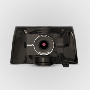
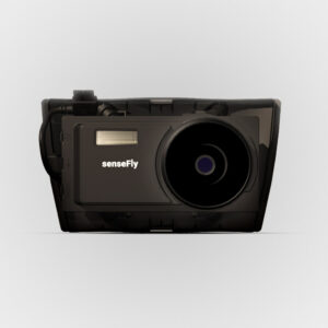
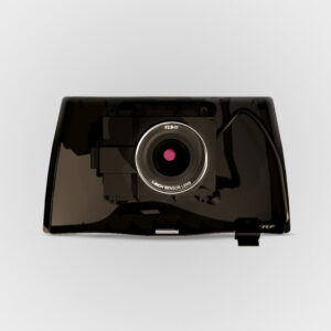
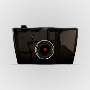
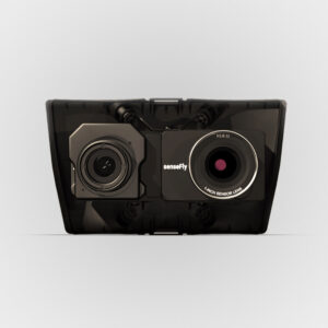
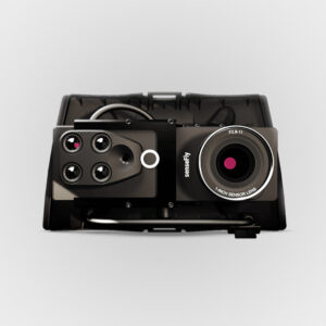
eBee TAC Public Safety is compatible with a wide range of interchangeable photogrammetry cameras that capture reliable aerial imagery – from 3D models to orthomosaics – to suit every mapping job.

Lightweight Fixed-Wing Drone

Operate safely within more regulatory frameworks thanks to the eBee TAC’s light weight, which allows you to expand your range and operational possibilities. In addition, it has the best ratio energy/MTOW compared to heavier VTOL drones, offering better energy efficiency.

Remote ID

eBee TAC Public Safety has Remote ID identification system approved by the Federal Aviation Administration (FAA).

Drone Cameras Available for the eBee TAC Public Safety

Enhance the capabilities of the eBee TAC Public Safety with a range of drone cameras, designed to capture essential data for informed decision-making. The selection includes advanced sensors capable of generating detailed 3D models, thermal maps, terrain and surface models, as well as high-resolution orthomosaics.

AgEagle eBee TAC Public Safety drone With Payload
Sensefly eBee X SODA3D Sensor

S.O.D.A. 3D

Sensefly eBee X Aeria X Sensor

Aeria X

Sensefly eBee X SODA Sensor

S.O.D.A.

Sensefly eBee X Corridor Sensor

Corridor

Sensefly eBee X Duet T Sensor

Duet T

Sensefly eBee X Duet M Sensor

Duet M

PLATFORMS

SENSORS

SOFTWARE

ACCESSORIES

SERVICES

SPEAK WITH AN EXPERT

Contact us to meet with a member of the Drone Nerd’s team to discuss the right solution for you.