Agremo
Crop Monitoring & Field Analytics Platform
Agremo uses artificial intelligence to analyze drone and aerial imagery and deliver field data through clear maps and reports.
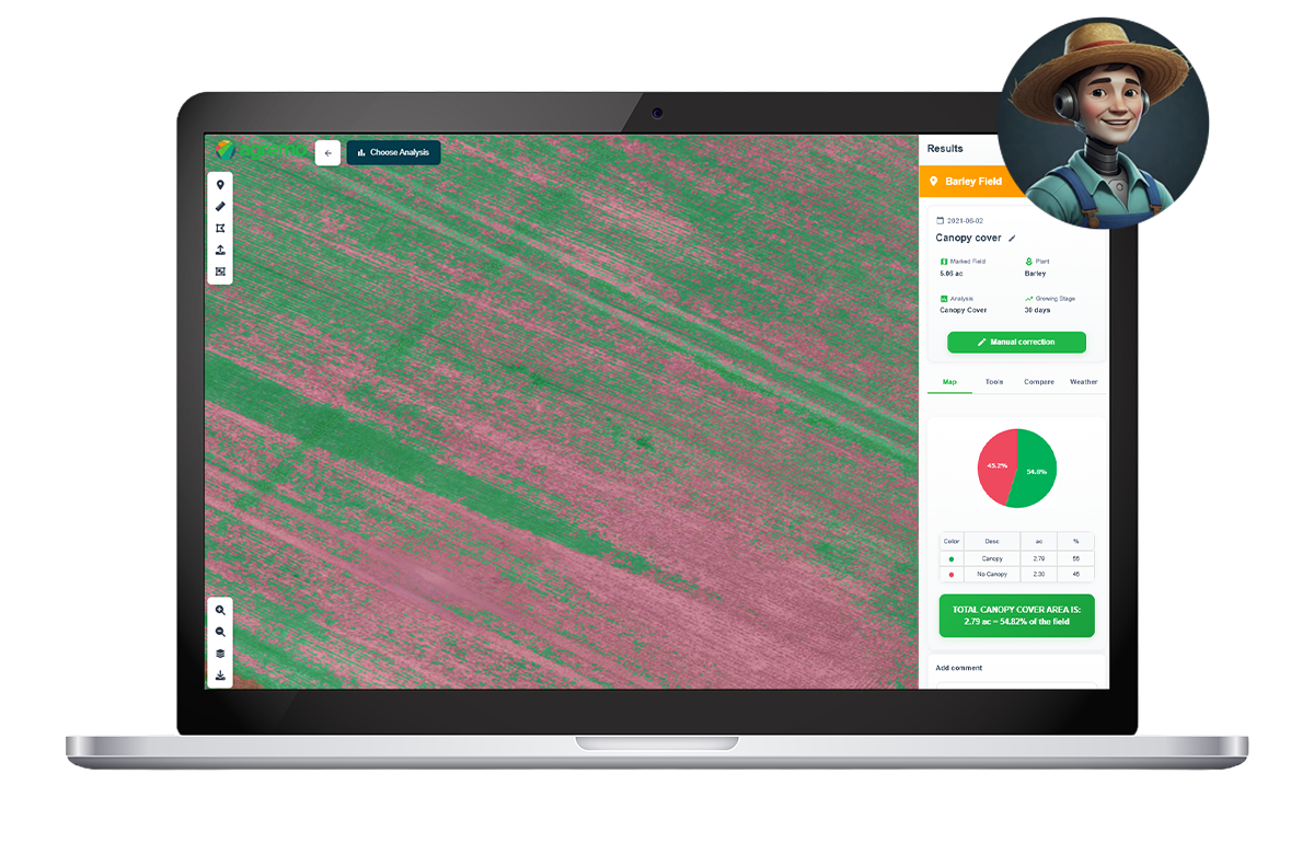
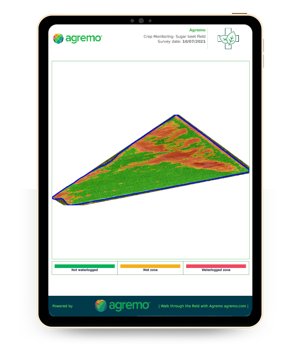
Agremo enables the analysis of crop health by processing aerial imagery and identifying variations across the field. The platform detects patterns related to plant condition and field variability, helping users monitor crops throughout the growing season using consistent, data-driven insights.
Crop Monitoring
Focused on season-long crop analysis using drone or satellite imagery.
Field Trials
Designed for research and testing environments.
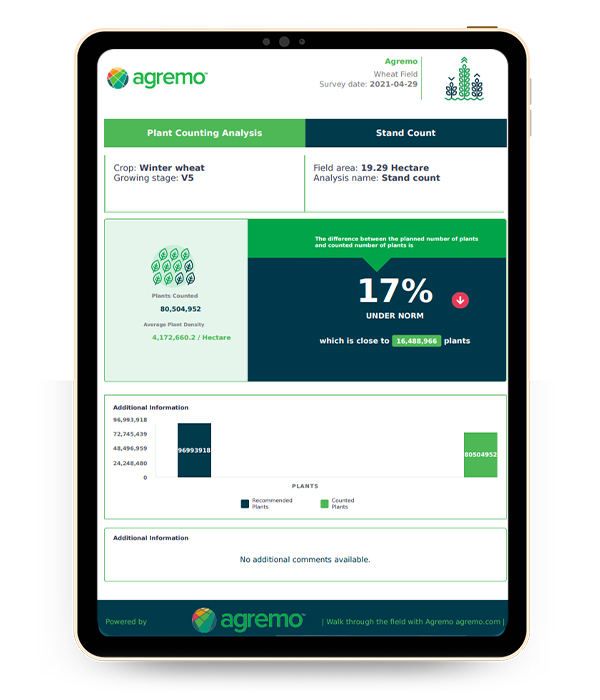
Plant Counting
Focused on inventory and plant population analysis.
GENERATE ACCURATE FIELD DATA
Using AI-based analysis, Agremo provides measurable data such as plant population, vegetation indices, and field variability maps. These outputs are delivered in structured reports, allowing users to review and interpret field conditions with precision.
ANALYZE CROP HEALTH AND FIELD CONDITIONS
Agremo works with widely used agriculture drones, including the DJI Mavic 3 Multispectral and DJI Agras Series. Contact one of our drone experts to learn more about compatible workflows and solutions.
From Imagery to Reports
After uploading drone or aerial images, Agremo processes the data and generates maps and analytics results. The platform is designed to convert imagery into usable outputs that support further field evaluation and planning.
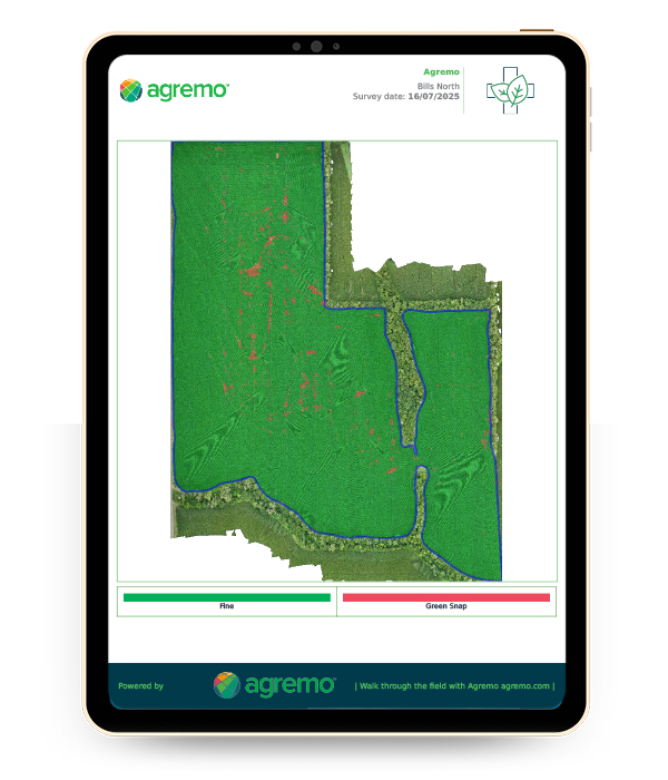
Create Maps for Field Operations
Agremo enables the creation of maps that can be used for field operations, including variable application planning. These maps are based on analyzed data and reflect differences detected across the field.
Make Data-Driven Decisions
By turning aerial imagery into structured insights, Agremo provides a way to monitor crops, analyze field conditions, and generate data outputs that support agricultural workflows.