Freefly FLUX LiDAR Series
Built to Power Your Data Workflows
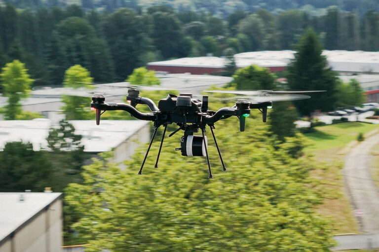
Meet the new FLUX LiDAR series, Freefly Systems’ latest release designed for teams that depend on accurate, repeatable aerial data. The Freefly FLUX LiDAR series supports mapping, inspection, and measurement workflows, with seamless integration into Freefly’s Astro and Alta X drone solutions.
FLUX H1
Long-Range LiDAR for Efficient Aerial Workflows
The FLUX H1 delivers professional-grade LiDAR in a lightweight sub-700 g package, built for operators who need highly accurate missions. Featuring the Hesai XT-32MX scanner and a 20 MP RGB camera, the H1 captures dense, high-fidelity data with centimeter-level precision. Designed for global travel and all-day missions, it’s the perfect solution when accuracy, portability, and reliability are non-negotiable.
FLUX O1
NDAA-Compliant LiDAR for Mission-Critical Data Capture
The FLUX O1 combines the proven performance of the Ouster OS1 scanner with NDAA compliance, making it the trusted choice for scanning sensitive or regulated sites. Lightweight, versatile and easy to use, the O1 provides industry-leading point cloud density in a compact form factor, ensuring you capture every detail of your mission-critical assets.
FLUX L1
Long-Range LiDAR for Efficient Wide-Area Coverage
The FLUX L1 makes professional LiDAR mapping more accessible without compromising on capability. Powered by the Livox Avia scanner, the L1 offers long-range coverage and non-repetitive scanning patterns ideal for power line inspection, forestry, and hard-to-map assets. Affordable, reliable, and lightweight, it’s the entry point to high-value 3D capture.
LiDAR Solutions Designed for Field-Ready Enterprise Deployment
This lineup features the FLUX H1, O1, and L1, offering distinct performance characteristics across weight, range, point density, and compliance needs, giving organizations flexibility to choose the right system for their operational requirements.
SPEAK WITH AN EXPERT
