PARROT ANAFI UKR GOV

A Sovereign ISR Micro-UAV for Public Safety, Government, and Defense

SHOP NOW

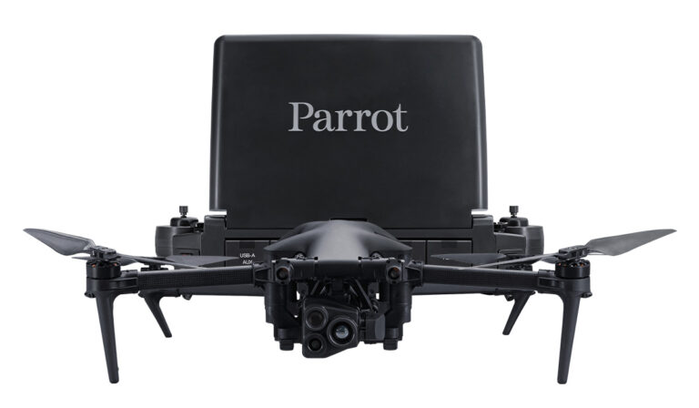
A DRONE DESIGNED FOR FIRST RESPONDERS & ENTERPRISE PROFESSIONALS


Purpose-built for mission-complex environments, the ANAFI UKR GOV is designed to stay airborne for up to 70 minutes, enabling long-duration flights under perilous conditions. It features resilience against jamming and spoofing through encrypted communications via LoRa, 5G, and Wi-Fi.
Parrot ANAFI UKR GOV micro-UAV Drone

KEY FEATURES

Parrot-ANAFI-UKR-Flir-Boson
Parrot-ANAFI-UKR-77-DB
Parrot-ANAFI-UKR-Cursor-on-Target
Parrto-ANAFI-UKR-Cybersecurity
Parrot-ANAFI-UKR-Optical-Navigation
Parrot-ANAFI-UKR-Remote-Antenna
Parrto-ANAFI-UKR-77-Drone-Operation
SKYCONTROLLER-UKR-Operator
SKYCONTROLLER-UKR-Mission

SKYCONTROLLER UKR GOV

The Skycontroller UKR GOV is designed to control and command Parrot ANAFI UKR GOV drones. It features a LoRa backup radio system and Wi-Fi connectivity. This ground control station also allows users to pilot an ANAFI UKR GOV remotely indoors or from inside a vehicle, whilst a second Skycontroller UKR GOV is deployed outdoors acting as a remote antenna. The controller is supplied on demand with a Samsung tablet; it is also compatible with an iPad Mini.

KEY SPECIFICATIONS

Parrot ANAFI UKR GOV with SKY Controller GOV

AIRCRAFT

  • Maximum transmission range:
    • 5G*: range without limits
    • Wi-Fi*: 5 km / 3.1 mi
    • LoRa: 20 km / 12.43 ms
  • Maximum wind resistance:
    • During flight: 15 m/s
    • During take-off and landing: 15 m/s
  • Sound power level at 1 m (3 ft): 77 dBA
  • Service ceiling: 5,000 m above MSL (Mean Sea Level)
  • Operating temperature: -36 °C to +50 °C (-33 °F to +122 °F)
  • IP53: rain and dust resistant
  • No NFZ (No-Fly Zones) limitation
  • Takes off from / lands in the hand of the operator
  • Optical navigation for GNSS-denied flight
  • Indoor flight
  • Deployment time: < 2 min
  • 70 Minute Battery Life

SENSORS

  • Satellite navigation: GPS, GLONASS, Galileo & BeiDou
  • Barometer and magnetometer
  • Front and vertical stereo cameras, and vertical range sensor
  • 4 x 6-axis IMU (3-axis accelerometers + 3-axis gyroscopes)

CYBERSECURITY

  • Zero data shared without user consent
  • Manage your data privately between drone and device or share anonymous data on secured European servers
  • SD card AES-XTS encryption with a 512-bit key
  • Digitally signed firmware
  • Compliant with FIPS140-2

EO IMAGE CHAIN

  • 2 sensors: 1/2.4”
  • Digital zoom: 35x
  • Electronic shutter speed: 1/25 s to 1/10,000 s
  • ISO range: 100 – 12,800
  • Video resolution: 4K / FHD / HD
  • Video format: MP4 (H.264 & H.265)
  • Photo resolutions: Wide: 21 MP (84° FOV), Rectilinear: up to 16 MP (up to 75.2° FOV)

IR IMAGE CHAIN

  • Sensor: FLIR BOSON – Resolution: 640 x 512 px
  • Temperature range: -40 °C to +250 °C (-40 °F to +482 °F)
  • Thermal sensitivity: ≤60 mK
  • Measured IR wavelength range: 8 to 14 micrometers
  • Video resolution: UHD (2160p) at 8.6 fps

IMAGE STABILIZATION

  • 3-camera IR/EO stabilized gimbal:
  • Hybrid, Mechanical & Electronics (EIS): 3-axis
  • Controllable gimbal tilt range: -90° to +90°

ADVANCED FLIGHT APP – FREEFLIGHT 8

  • Flight Planning with waypoints and points of interest
  • Object recognition & tracking
  • Cursor On Target
  • Video streaming & recording
  • EO and IR cameras settings management
  • Touch & Fly
  • Flight logs recording and reviewing

SPEAK WITH AN EXPERT

Contact us to meet with a member of the Drone Nerd’s team to discuss the right solution for you.